Tag Archives: Litli Hrutur

Eruption Started Near Litli Hrútur, Iceland

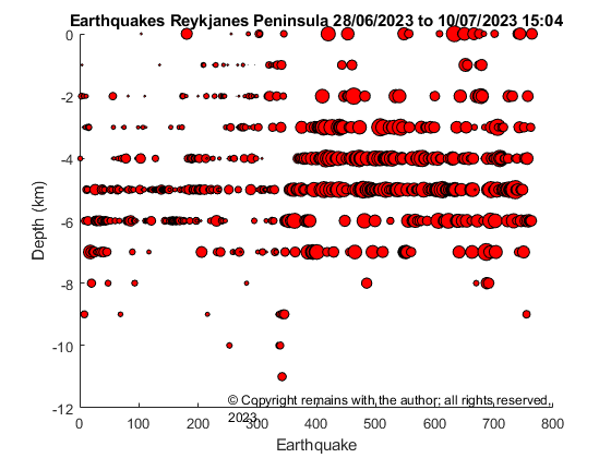
Updated for earthquake plots from 28th June 2023 to 10th July 15:04 (pre eruption) for the Reykjanes Peninsula

Fig 1: Screenshot from RUV.is webcam on Litli Hrutur. The eruption site is behind the hill. Source: https://www.ruv.is/frettir/innlent/2023-07-06-beint-streymi-fra-fagradalsfjalli-387091

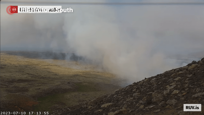
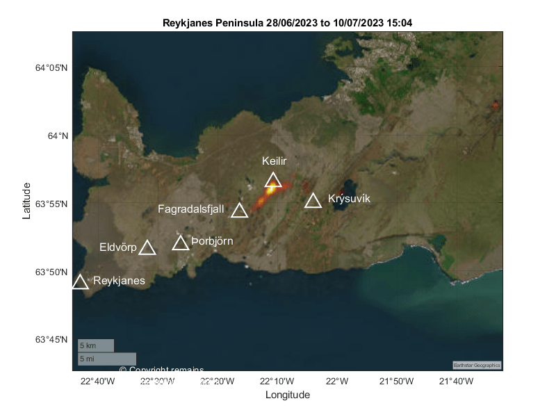
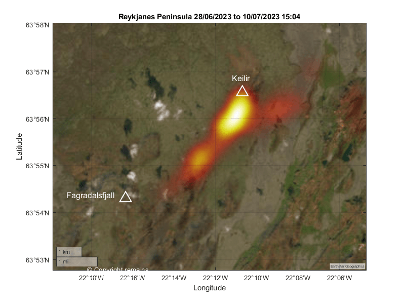
The Icelandic Met Office has confirmed the onset of an eruption on the eastern and northeastern flanks of Litli Hrútur, Iceland. The eruption started around 16:40 today with the opening of three small fissures on a 200m fault. Lava is collecting in a depression then flowing southwards, with gas and steam emissions going northwestwards.

Fig 2: Image by  Benedikt Ófeigsson from IMO’s facebook page showing the two fissures. Image appears to have been taken from Lilti Hrútur. Source: https://www.facebook.com/photo/?fbid=701454135343917&set=a.312131834276151

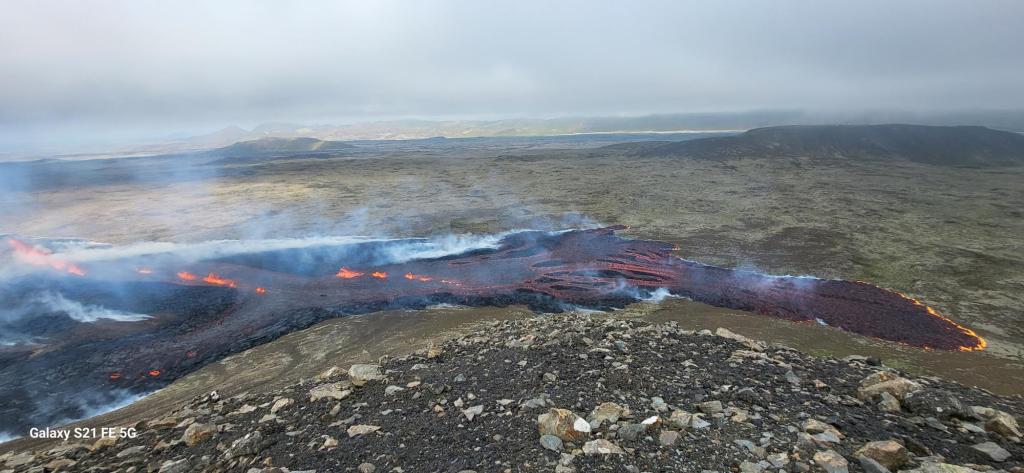
Images taken by Jakob Vegerfors, which he posted onto Facebook, show two initial fissures. The images can be found here: https://www.facebook.com/photo?fbid=10159116738742038&set=pcb.1442657949904754 The hill in the left foreground is Litli Hrutur and the larger hill to the right in the background is Kelir.

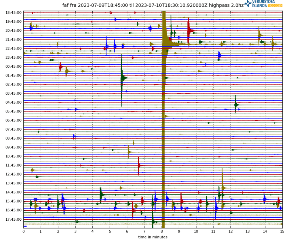
IMO reported noticing a disturbance on the earthquake station at Fagradaslfjall last night and again at 14:00 today similar to those preceding the 2021 and 2022 eruptions.

Fig 3: Helicorder plot for Fagradalsfjall today. Source: IMO

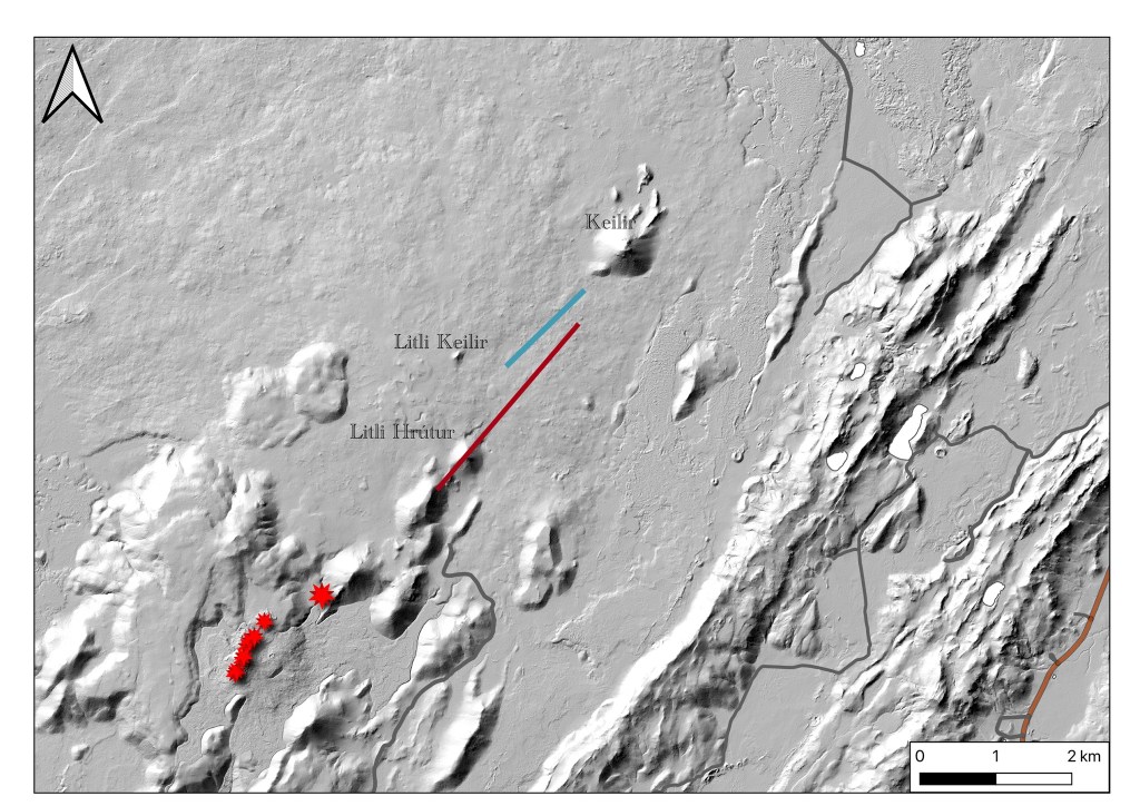
The eruption site appears to be a little east of the southern end of the calculated position of the dyke intrusion.

Fig 4: Calculated position of the dyke instrusion (red line) from IMO. Red stars show the position of earlier eruptions (2021 and 2022). The blue line is the location of surface deformation from ICEYE wave interference images taken 7-8 July. Location of surface fracture and insert model determined by Michelle M. Parks and Vincent Droin, Icelandic Meteorological Office. Photo: Ásta Rut Hjartardóttir, University of Iceland

We have updated our earthquake plots from 28th June 2023 to 10th July 2023 15:04 for the Reykjanes Peninsula. We used the 764 confirmed earthquakes published by IMO on https://skjalftalisa.vedur.is/#/page/map. The total number of earthquakes in the swarm was c.12,000 as of 9th July 2023.

Fig 5: Geoscatter plots by the author for 28th June 2023 to 10th July 2023 15:04. Colour denotes age: red is the oldest, yellow the youngest.  © Copyright remains with the author; all rights reserved, 2023
Fig 6: Scatter plots by the author for 28th June 2023 to 10th July 2023 15:04. Colour denotes age: red is the oldest, yellow the youngest.  © Copyright remains with the author; all rights reserved, 2023
Fig 7: Scatter plots by the author of quake v depth for 28th June 2023 to 10th July 2023 15:04. Size denotes magnitude.  © Copyright remains with the author; all rights reserved, 2023
Fig 8: Geodensity plots by the author for 28th June 2023 to 10th July 2023 15:04. © Copyright remains with the author; all rights reserved, 2023
Fig 9: Zoomed in geodensity plot by the author for 28th June 2023 to 10th July 2023 15:04. © Copyright remains with the author; all rights reserved, 2023

Apparently the eruption site is difficult to get to. If you intend to visit, please follow the advice of the local authorities and stay safe.

For local news sources, try

IMO: https://en.vedur.is/ and their Facebook page, https://www.facebook.com/Vedurstofan

RUV.is: https://www.ruv.is/frettir

MBL.is: https://www.mbl.is/frettir/

For local webcams, try

https://www.ruv.is/frettir/innlent/2023-07-06-beint-streymi-fra-fagradalsfjalli-387091

Armchair Volcanologist

© Copyright remains with the author; all rights reserved, 2023.