Update, 19th January 2024
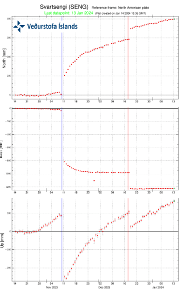
There are no signs of eruptive activity, however, inflation still continues at Svartsengi.
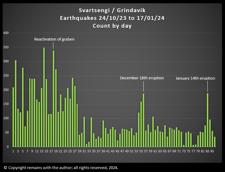
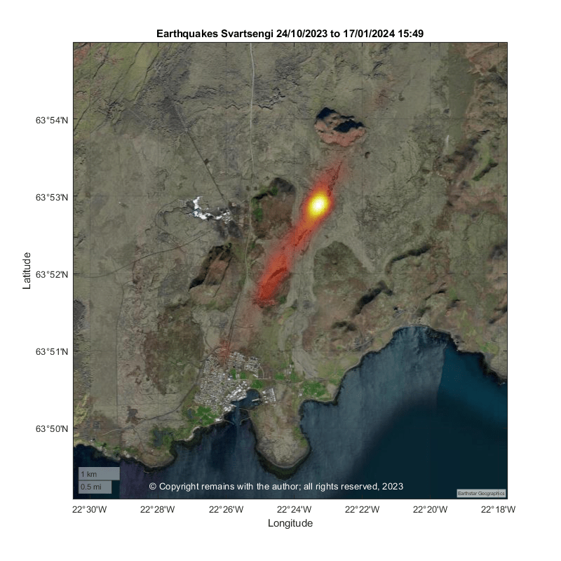
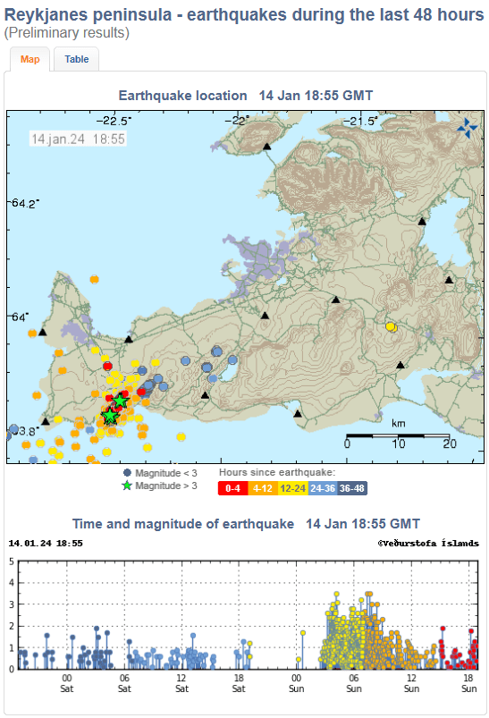
We have updated our earthquake plots to 17th January 15:49. The geodensity plot shows an increase in density south westwards from the hotspot. The geoscatter plots (latitude v longitude) show the development of seismic activity near Fagradalsfjall after the December eruption in addition to activity at Svartsengi / Grindavík.
We recommend that you watch the videos on YouTube rather than here; you can adjust the size and speed more easily there.
Update, 17th January 2024
IMO are reporting that a new graben has formed to the east of the graben which formed in November 2023. The new graben is between 800m and 1,000m wide with a depth of up to 30cm, whereas the older graben is 2km with with depths of up to 1.3m. The new graben is widening and deepening. Unfortunately, this increases the risk of new fissures in and around Grindavík.
Because a new graben has formed the magma intrusion which supplied the 14th January 2024 eruption is thought to be further east than that which supplied the 2023 eruptions.
Meanwhile, inflation at Svartsengi continues. This is thought to be due to more magma entering the system.
Update, 16th January 2024
From what we can see on the webcams, the eruptive activity (or this phase of the eruption) seems to have ended on the northern fissure at around midnight last night. Activity on the southern fissure ended yesterday.
It is too early for the eruption to be declared over. Inflation continues at Svartsengi and has resumed at the stations which recorded initial inflation. New fissures may open with little to no warning.
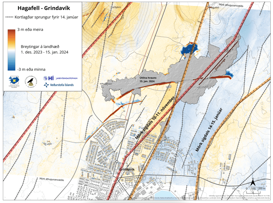
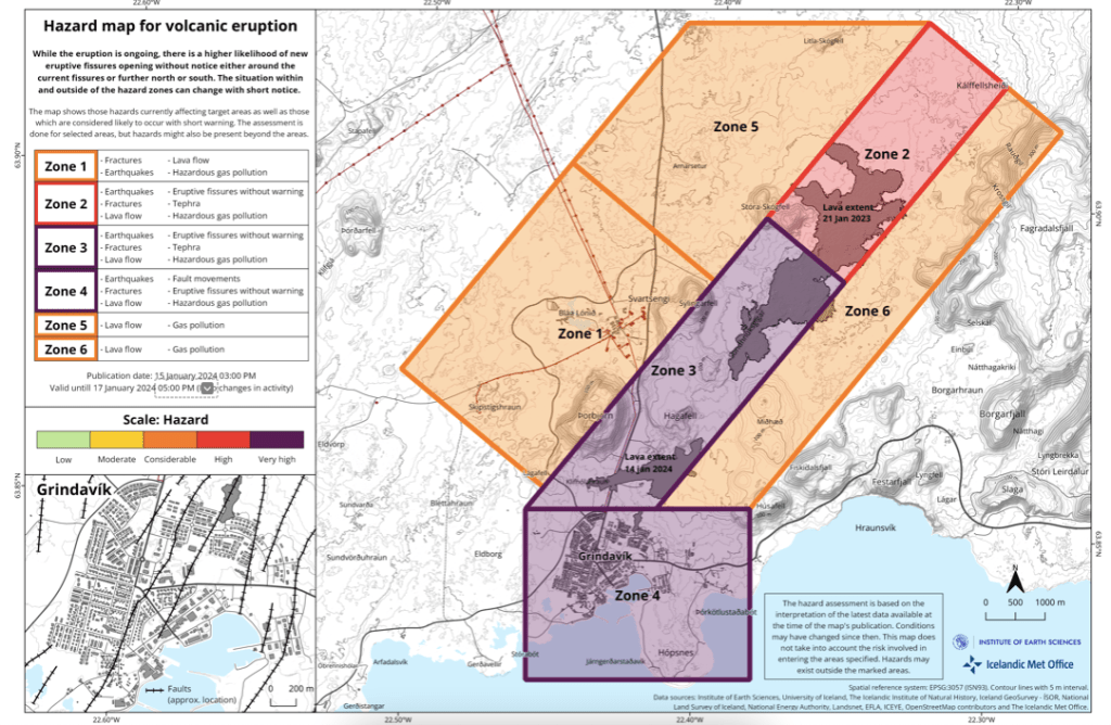
Three properties were lost to lava. The defensive walls were effective in diverting most of the lava flow from the town, itself, despite not being completed. We do not know whether or not livestock and pets trapped in the town have been rescued. The full damage to the town has yet to be assessed. However, due to ground deformation with displacement of up to 1.4m spread over existing and new fissures, new surface cracks can appear without warning.
IMO has published an updated hazard map:
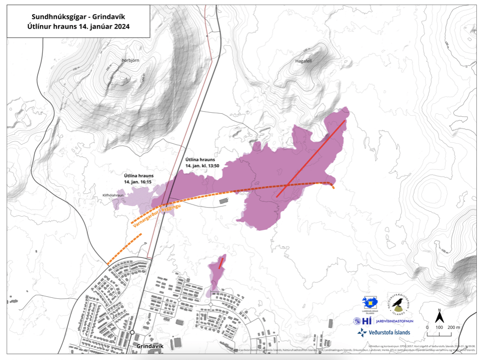
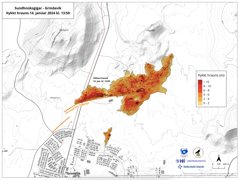
IMO has also published maps showing the extent of the lava flow as of yesterday and thickness of the lava flow. The se also show how the defensive walls diverted lava and lava pooling by the defensive wall.
Original Post, 14th January 2024
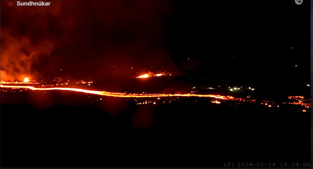
Two eruptive fissures have opened north of Grindavík today. The summary below is sourced from IMO’s updates and RUV’s live English blog.
Inflation at Svartsengi had continued uninterrupted since the 18th December 2023 eruption at the Sundhnúksgígar crater row. A new earthquake swarm started before 03:00 UTC today (14th January 2024) at the the Sundhnúksgígar crater row migrating south westwards towards Grindavík. By 05:30am both seismicity and ground deformation indicated that the magma intrusion had propagated under the town.
A fissure opened east of Þorbjön and southeast of Hagafell, the southern most part of which was 900m from Grindavík. By 10:44, the fissure was around 1 km in length. A second fissure opened at 12:10 just north of the town. Lava has now entered the town.
Grindavík was evacuated at c.03:00 this morning. However, some sheep and other animals kept in the town were trapped.
The defensive walls built to protect the town from lava were working well, despite not being completed, until the second fissure opened; the fissure’s southern most end was south of the defensive walls.
The authorities are asking that sight seers keep away from the site at the moment. We have given links to some webcams where you can view the eruption live.
Armchair Volcanologist
© copyright remains with the author; all rights reserved, 2024.
Sources:
IMO: An eruption has started | News | Icelandic Meteorological office (vedur.is)
RUV.is: Eruption north of Grindavík – RÚV.is (ruv.is)
Webcams: Bein streymi frá gosstöðvum – RÚV.is (ruv.is) and Webcams – Live from Iceland – Webcams around Iceland
