At the time of writing, the eruption has not materialised. The swarm continues, albeit the magnitude and number of the earthquakes has decreased.
The status of Grindavík has been downgraded from “emergency” to “danger”. The aviation code has been reduced to yellow. If an eruption does ensue from this swarm, the most likely location is between Hagafell and Sýlingarfell.
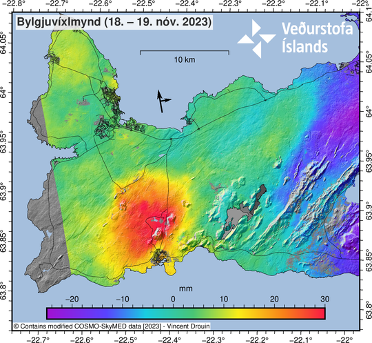
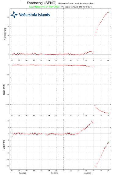
On 21st November 2023, IMO reported significant uplift in the vicinity of Svartsengi. While an eruption may follow here, it is thought that it would be preceded by an increase in seismic activity. There is still a likelihood of an eruption near the magma intrusion. Since then, uplift has continued.
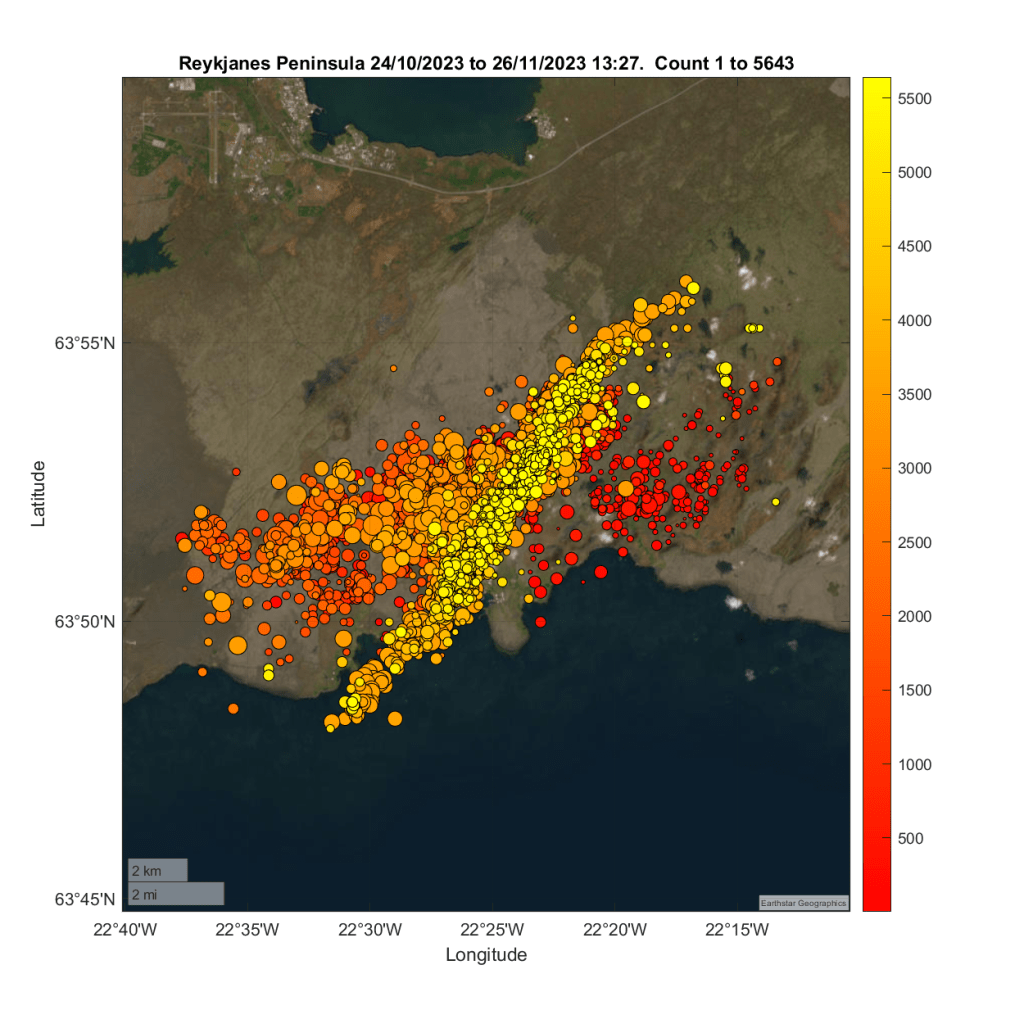
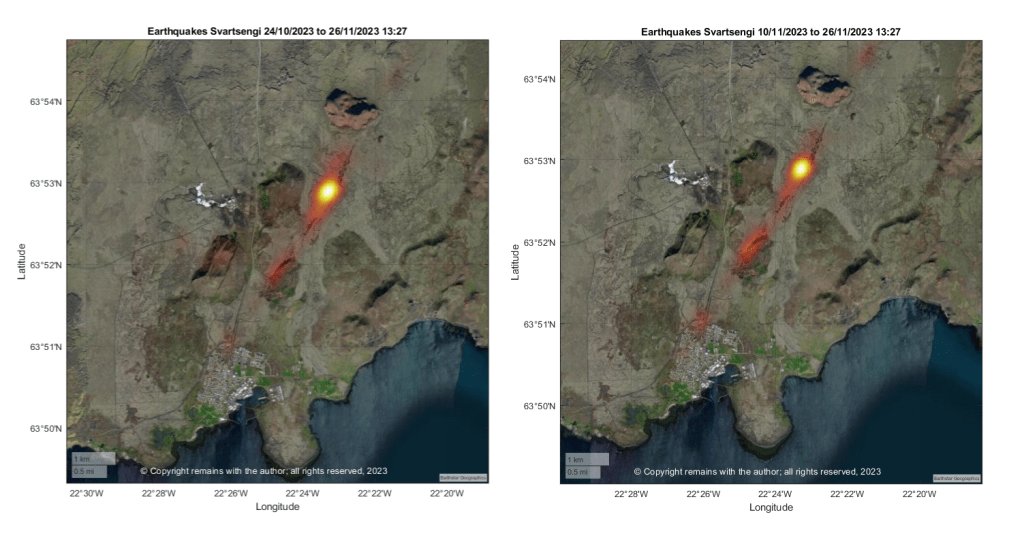
We have updated our earthquake plots from 24th October 2023 to 26th November 2023 13:27. Most activity is occurring along the magma intrusion, although it is focussed more on the area to the east of Sýlingarfell on Sundhnúksgigar.
We have summarised earthquake activity by day in the following video.
Our plots show faults responding to magma, with decreasing seismic activity along the possible dyke formation since the reactivation of the graben. This may reflect the fact that magma has reached less brittle layers or most of the seismicity associated with the magma intrusion was in fact due to tearing of the crust in response to the inflation at Svartseni and environs, which, in turn, may or may not have allowed magma to flow into the formation. Time will tell.
Since our earthquake plots were compiled, there has been another small swarm to the east of Sýlingarfell.
We believe that this is the calm before the storm (an eruption) but when will the storm break?
For updates, please consult the relevant authorities, e.g IMO (link below).
Armchair Volcanologist
© Copyright remains with the author; all rights reserved, 2023.
Source for raw earthquake data: IMO, https://en.vedur.is/
