While waiting to see where and when the next eruption on the Reykjanes Peninsula occurs, we have updated our earthquake plots for the area between 63.746°N, 22.631°W and 63.996°N, 21.864°W from 24th October 2023 to 9th March 2024 – a total of 12,988 earthquakes. We have extended the area plotted to include Krýsuvík.
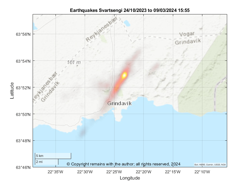
First, we start with the geodensity plot for the period 24th October 2023 to 9th March 2024. Most activity is still occurring on the magma intrusion / graben between Hagafell and Stóra-Skógafell. The earthquake density plots for the entire period also picks up some activity southwest of Grindavík, west of Fagradalsfjall and at Mount Þorbjörn. This shows best on a topographic map with a lighter background.
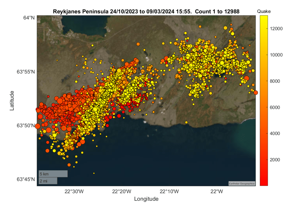
Next, we look at the geoscatter plot for the same area and period. This shows the activity along the magma intrusion / graben, that west of Fagradalsfjall, and, also, an upkick in activity in the Krýsuvík area. The last may be local faults accommodating the uplift at Svartsengi. Whether or not this lets magma ascend in the Krýsuvík volcanic system, itself, remains to be seen. At the time of writing, the alert level for Krýsuvík is unchanged at green.
We have complied a video of the earthquake sequence in increments of 50 quakes.
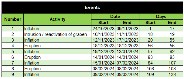
We have also looked at the sequence by the various events (inflation, intrusion / graben formation and eruption). The events are:
For each event we have done the geodensity and geoscatter plots. These can be found in the video below.
Other plots
We hope you find the above plots useful.
Armchair Volcanologist
© Copyright remains with the author; all rights reserved, 2024.
Source:
Our thanks go to IMO for the raw earthquake data. IMO: Icelandic Meteorological Office
