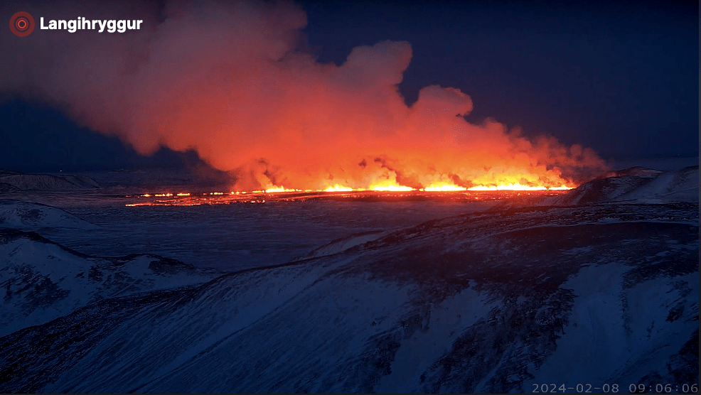
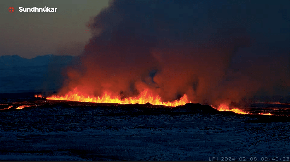
The eruption start early this morning at 6am with a 3km long fissure near to the location of the 18th December 2023 eruption. Lava is flowing westwards.
At the time of writing there is no immediate threat to Grindavík the Blue Lagoon or Svartsengi Power Plant. No-one is thought to have been in Grindavík when the eruption started; the Blue Lagoon was evacuated successfully. It will be some time before lava may reach the protective walls round Grindavík.
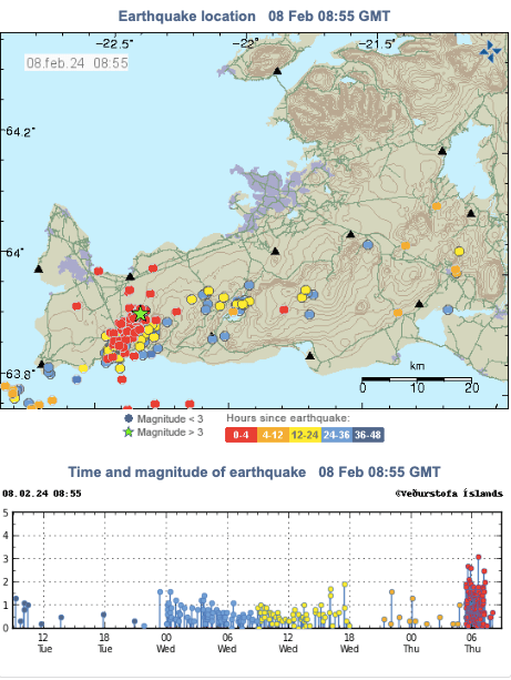
The eruption started with little notice. The precursors were an earthquake swarm which started 30 minutes before at 5:30 am and around ten minutes later pressure changes in bore holes at the power plant were noted.
The eruptive mechanism is similar to the two previous eruptions. Magma flows into the channel and then erupts with jets of lava. Lava fountains are currently reaching 80m height and the plume rises to 3km.
Inflation has been continuous at Svarsengi since the December 18th eruption. It is too soon to see what effect thus eruption has had on local ground deformation.
At the time of writing, the eruption has not materialised. The swarm continues, albeit the magnitude and number of the earthquakes has decreased.
The status of Grindavík has been downgraded from “emergency” to “danger”. The aviation code has been reduced to yellow. If an eruption does ensue from this swarm, the most likely location is between Hagafell and Sýlingarfell.
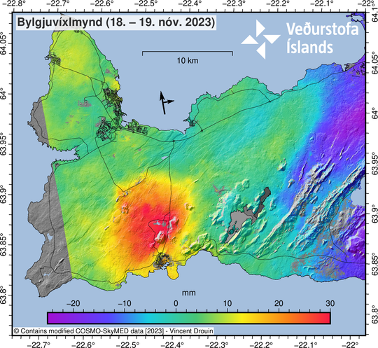
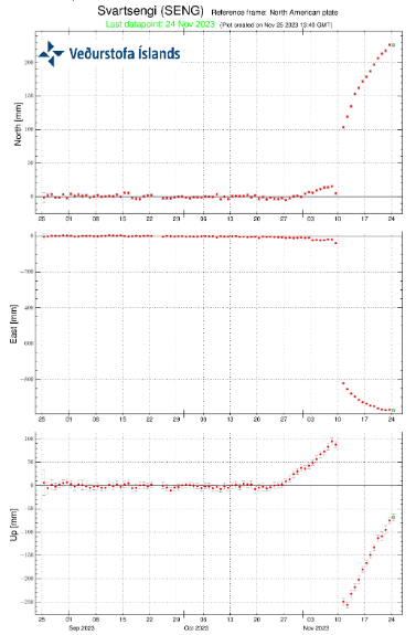
On 21st November 2023, IMO reported significant uplift in the vicinity of Svartsengi. While an eruption may follow here, it is thought that it would be preceded by an increase in seismic activity. There is still a likelihood of an eruption near the magma intrusion. Since then, uplift has continued.
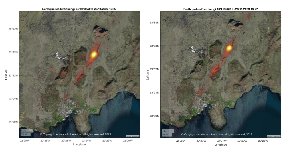
Fig 33: COSMO-Skymed interferogram spanning 24-hours between 18−19 November at 06:41. The broad uplift signal visible in orange/red around Svartsengi is indicative of inflation occurring at a depth of > 5km. Source: IMO
Fig 34: GPS from IMO showing ground deformation at Svartsengi. There was initial uplift at the start of the swarm, followed by large drop when the graben was reactivated / dike formed, which, in turn, is followed by resumed uplift. Source: IMO.
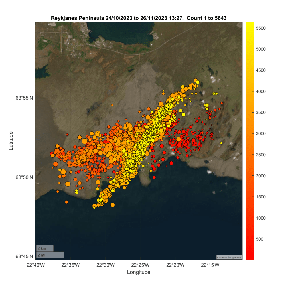
We have updated our earthquake plots from 24th October 2023 to 26th November 2023 13:27. Most activity is occurring along the magma intrusion, although it is focussed more on the area to the east of Sýlingarfell on Sundhnúksgigar.
Our plots show faults responding to magma, with decreasing seismic activity along the possible dyke formation since the reactivation of the graben. This may reflect the fact that magma has reached less brittle layers or most of the seismicity associated with the magma intrusion was in fact due to tearing of the crust in response to the inflation at Svartseni and environs, which, in turn, may or may not have allowed magma to flow into the formation. Time will tell.
Since our earthquake plots were compiled, there has been another small swarm to the east of Sýlingarfell.
We believe that this is the calm before the storm (an eruption) but when will the storm break?
For updates, please consult the relevant authorities, e.g IMO (link below).