28 February 2021 (updated 2 March 2021 with the addition of earthquake plots showing rifting / dike formation)
Good Evening!
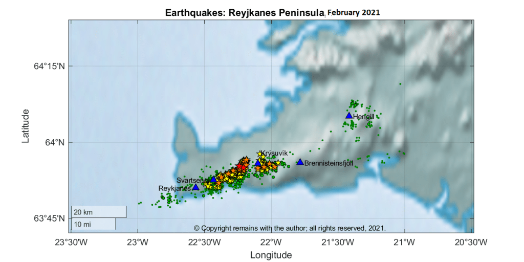
A large earthquake swarm started on 24 February 2021 on the Reykjanes Peninsula in the vicinity of the Krýsuvík volcanic system between Kleifarvatn and Svartsengi. At the time of writing the swarm is still ongoing with over 7,200 earthquakes record by Iceland’s SIL system. Three earthquakes of 5.0M or more have been recorded: 5.7M and 5.0M on 24 February and a 5.2 on 27 February 2021.
The alert level for the Krýsuvík volcanic system has been raised to yellow following sightings of steam jets in geothermal areas in the region after the 5.7M and 5.0M.
The Icelandic Met Office have attributed this swarm to the recent re-awakening of volcano-tectonic activity on the Peninsula.
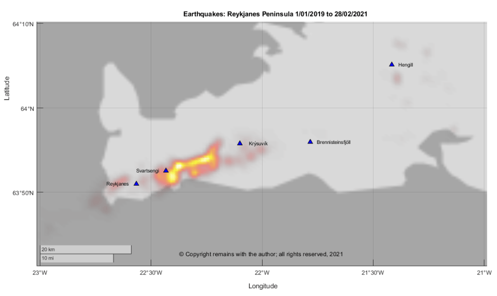
We downloaded the confirmed earthquakes from IMO’s site to take a look. We plotted earthquake density for Week 8, 2021, earthquake locations for February 2021 and earthquakes by month from January 2009 to February 2021.
From our plots we can see the awakening of the volcano-tectonic activity with the upkick in number of earthquakes from December 2019. The current swarm is part of this activity.


At the time of writing, it is not possible to predict whether or not this activity will result in a local eruption in the near future. Only time will tell.
Update 1 & 2 /03/2021
Since writing the swarm has continued, with more than 15,000 earthquakes since it began last week.
The Department for Civil Protection has advised on 1 March 2021, that satellite images show deformation in the area has increased more than expected, indicating possible magma inflow.
We can see from the local GPS stations that there has been significant uplift near Krýsuvík.

We have also produced scatter plots by day for the swarm in week 8, 2021 which show possible rifting or dike formation.
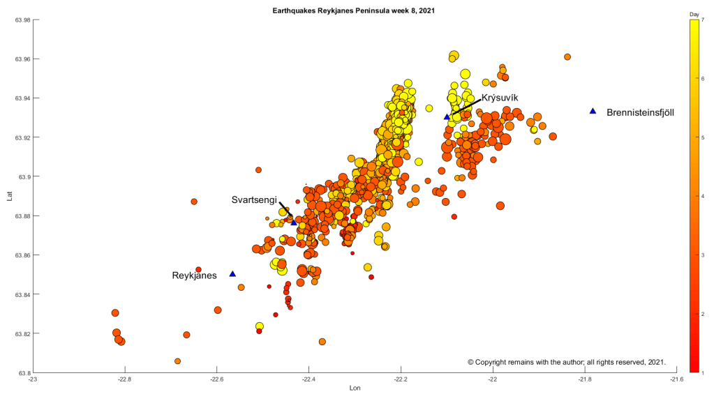

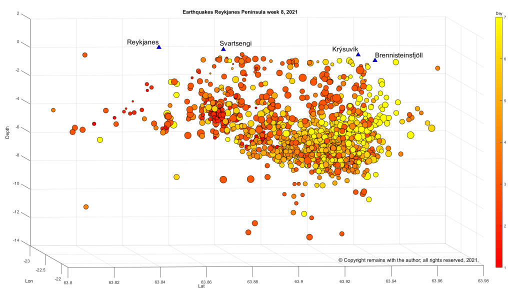
IMO are updating the list of earthquakes for week 8, 2021, at the time of writing. For up-to-date information, please consult IMO.
The Armchair Volcanologist
© Copyright remains with the author; all rights reserved, 2021.
Sources:
Raw earthquake data and status: the Icelandic Meteorological Office: www.en.vedur.is
Department of Civil Protection and Emergency Management | Almannavarnir

One thought on “Seismic Activity on the Reykjanes Peninsula”
Comments are closed.