Good Evening,
19.03.2021

This was going to be a post with an update on the earthquake swarm on the Reykjanes Peninsula, but the magma beat me to it! IMO has just confirmed that a volcanic eruption is underway near Fagradalsfjall at Geldingadalur. The eruption started at 20:45 19.03.2021. It has been named as Geldingadalsgos, after the valley. At the time of writing, the eruption is a small fissure eruption; the fissure is c. 0.5km long.
The public have been advised not under any circumstances go close to the eruption site or on Reykjanesbraut. First responders need to be able to drive freely to assess the situation. Scientists are working on assessing the eruption, the site and possibilities.
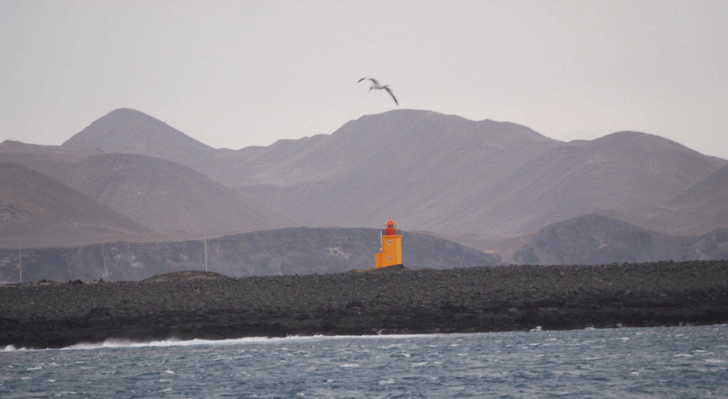
People living nearby in Þorlákshöfn have been instructed to stay indoors, close windows and turn up their heating to avoid exposure to any volcanic gases. The Reykjanesbraut has been closed – the main road from the capital region to Reykjanesbær and the international airport at Keflavík.


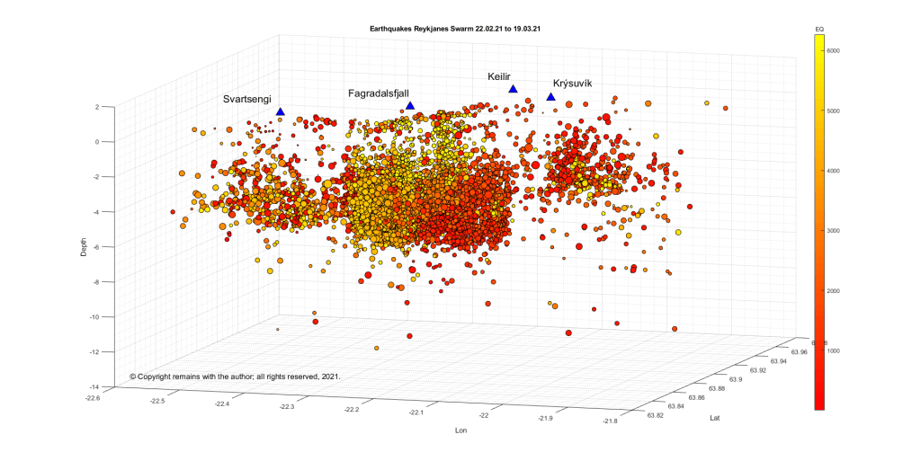
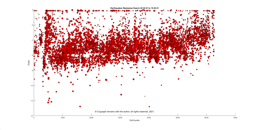
Here are the updated earthquake plots by the author, anyway. The raw earthquake data has been obtained from IMO; this is confirmed earthquakes to date (19.03.2021 15:00). IMO’s page above gives the more recent earthquakes.
What we see from the plots is that seismic activity has now extended beyond Reykjanes to the west and the swarm is still active. Activity in the swarm is densest to the NE and SW of Fagradalsfjall. The depth plot shows that earthquakes in the swarm are tending to be smaller and shallower.
Extension of the swarm to the west is in keeping with the swarms which have occurred since December 2019.


Let’s hope that this is a “tourist eruption”; our thoughts are with anyone affected by this eruption.
For more up to date information, please consult IMO or the Department for Civil Protection.
The Armchair Volcanologist
© Copyright remains with the author; all rights reserved, 2021.
Sources:
Plots by the author.
Source for raw earthquake data: IMO
Icelandic Meteorological Office – IMO (@Vedurstofan) / Twitter
Department of Civil Protection and Emergency Management | Almannavarnir
