Good Afternoon! (Updated 30/03/2022 to include Background)
On 19 March 2022 an earthquake swarm started on São Jorge, an island in the Azores. The swarm is ongoing at the time of writing. By 28 March 2022, c.14,000 earthquakes had been recorded. This swarm is likely to be caused by a magmatic intrusion.
INVOLCAN have estimated that up to 20 million cubic meters of magma may have accumulated under São Jorge during the swarm, based on satellite measurements of ground deformation. CIVISA (Centro de Informação e Vigilância Sismovulcânica dos Açores) has raised the alert level to V4 (out of a scale to V6. V5 and V6 are in eruption, based on size of the eruption).
There are four likely outcomes:
- An eruption occurs in the next few days to weeks, possibly with little warning.
- A larger earthquake occurs alongside changes in the magma intrusion leading to an eruption or stalling of the intrusion.
- The current swarm and deformation end without eruption. Future swarms and deformation lead to an eruption.
- The activity ceases and the intrusion cools with no further activity.
Locals have been advised to prepare to evacuate due to the risk of eruption or larger earthquakes. Our thoughts are with them.
Let’s take a look at what is going on underground. We have downloaded the earthquake data reported by The Portuguese Institute for Sea and Atmosphere, I. P. (Source: IPMA – Seismic map). This shows earthquakes ≥2.0 magnitude. At the time of our download c. 840 earthquakes ≥2.0 had been recorded for São Jorge from 19/03/2022.
Our video shows geoscatter plots by day, showing the north-westward migration of the swarm, and 3D rotating scatter plots.
Background
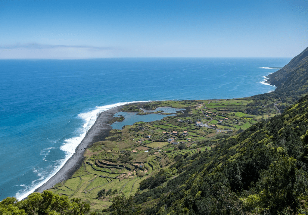
Around 8,400 people live on the island in settlements around the coast. Transport links have historical been by sea as land transport was inhibited by the harsh volcanic terrain. The economy is reliant on dairy farming, including the export of São Jorge cheese, fishing and some cereals, vineyards and local vegetables. The opening of an airport in 1982 led to the expansion of the export of cheese, farming and small crafts.
São Jorge Island, itself, is 55km long and 6km wide volcanic ridge in the Azores Archipelago. The Azores are located at a triple junction between the North American, Eurasian and Nubian Plates; the Mid Atlantic Ridge forms the eastern boundary of the North American Plate. The Azores Plateau is considered to be a large igneous province generated from a plume interacting with the Mid Atlantic Ridge between 20 and 7 million years ago. Fissural volcanic activity arising from the interaction and tectonics created the islands.
There are four known centres of volcanic activity on São Jorge: the São João area on the south eastern end of the island; the Topo Volcanic Complex, occupying most of the eastern side of the island; the Rosais Volcanic Complex, with basalt and andesites; and Manadas Volcanic Complex on the west side of the island. The earliest known subaerial lava is alkaline enriched c.1.32 – c.1.21 million years old from deep partial melting of an enriched garnet peridotite mantle source. This is located at the south east end of the island at São João with a NW-SE to NNW-SSE direction oblique to the current WNW -ESE axis of the island. The period includes at least thee episodes of magma differentiation from alkaline basalts to mugearites in a shallow magma reservoir. Subaerial activity resumed c. 750,000 years ago at the Topo Volcanic Complex, with several overlapping episodes migrating westward along the axis of the island. Activity in the western side of the island started c. 731,000 years ago. The lavas generated 750,000 years ago and subsequently were also generated from an enriched mantle source. The different phases of subaerial growth are attributed to different episodes of deformation reopening the magma feeding system. It is possible that submarine activity occurred during the period of apparent quiescence.
GVP lists 11 confirmed Holocene eruptions for São Jorge, of which one is VEI 3 (1580), one is VEI 2 (1800) and one is VEI 1 (1808). Three are submarine: 1964, off the SW coast; 1902, off Ponta do Topo; and, 1800, also off Ponto do Topo. The eruptions in 1580 and 1808 caused widespread damage. In the 1580 eruption, magma ascended from 23km or more, ponded at 16km and then erupted in three lava flows along the Ribeira da Almeida, Queimada and between Ribeiro do Nabo and the beach of Cruzes; ten people were killed. In the Urzelina eruption in 1808 , fractionated residual ponded magma from the 1580 eruption emerged as andesite-basaltic lava to flow south west of Pico do Pedro to Urzelina. This eruption caused gases and chloric, sulfuric and carboxylic acid vapours to be emitted from the Manadas Ridge, which along with eight large earthquakes, caused significant damage to property and farmland. Eight people were killed in the 1808 eruption.
The island and surrounding area is heavily faulted. Submarine fractures between the São Jorge and Pico have resulted in large damaging earthquakes. In 1757, an earthquake centred in Fajã dos Vimes resulted in destruction of property in Manadas and the death of c. 20% of its population (1,000 people).
A series of seismic swarms in February 1964 associated with an offshore eruption 6.5km northwest of Velas led to large earthquakes which destroyed most property in the western side of the island. The eruption was preceded by seismic activity starting tremors felt on 21 August 1963, followed by a swarm which lasted from mid-December 1963 to January 1964 and the cutting of submarine cables on 29 January and 1 February 1964. Volcanic tremors started on 14 February 1964, resulting in a large damaging earthquake on 15 February after a lull in activity. The earthquakes initially impacted Urzelina, Manadas, San António and Norte Grand before migrating north west to include Rosais, Beira, Velas, and Santa Amaro. Low intensity tremors occurred in the period before the next large events on 21 February 1964 when three large tremors caused more damage; this phase ended on 24 February 1964. Earthquake foci near the centre of the island had depths of 5km, whereas those near Velas were 10-20km in depth. Neighbouring islands also experienced large tremors. The event ended on 25 February 1964. 5,000 people were evacuated from the island during this time, not an easy task as storms in the channel between Terceira, Pico an b d Faial hampered relief efforts, along with lack of planning. This time with monitoring the authorities are better prepared.
Time will tell when the next eruption occurs on São Jorge. In the meantime, here’s hoping that the disruption to local residents is short-lived.
Armchair Volcanologist
© copyright remains with the author; all rights reserved, 2022.
Sources and Further Reading:
Anthony Hildebrand, Pedro Madureira, Fernando Ornelas Marques, Inês Cruz, Bernard Henry, Pedro Silva, “Multi-stage evolution of a subaerial volcanic ridge over the last 1.3 Myr: S. Jorge Island, Azores Triple Junction”, Earth and Planetary Science Letters, Volume 273, Issues 3-4, 15 September 2008, Pages 289 -298.
Anthony Hildebrand, Dominique Weis, Pedro Madueira, Fernando Ornelas Marques, “Recent plate re-organisation at the Azores Triple Junction: Evidence from combined geochemical and geochronological data on Faial, S. Jorge and Terceira volcanic islands”, Lithos, 210-211, (2014), 27-39.
Vittorio Zanon, Fátima Vieros, “A multi-method re-evaluation of the volcanic events during 1580 CE and 1808 eruptions at São Jorge Island (Azores Archipelago, Portugal), Journal of Volcanology and Geothermal Research, Volume 373, 15 March 2019, Pages 51–67.
Smithsonian Institution National Museum of Natural History Global Volcanism Program (GVP): São Jorge https://volcano.si.edu/volcano.cfm?vn=382030
1964 Rosais earthquake – Wikipedia
São Jorge Island – Wikipedia

_julesvernex2.jpg)