Good Afternoon!
We are looking again at the volcano basics, this time the hazards posed by volcanoes. This is not intended to put you off visiting a volcano; understanding the hazards is the first step towards mitigating volcanic risk.
Visiting a volcano
A quick word about visiting a volcano before we get into volcanic hazards.
It is usually possible to view an erupting volcano from a safe distance if you follow local official advice. Where there is an exclusion zone in place, the local authorities consider it too unsafe for the general public to go into that zone. Your insurance company and local rescue teams would probably take a very dim view of any accidents arising should you stray into the zone and need rescuing.
If you want to visit a volcano, do your research, take advice and have an enjoyable trip.
Volcanic risk mitigation
The purpose of volcanic risk mitigation is to reduce the losses from a volcanic eruption or other volcanic hazard. This involves understanding the hazards posed by the volcano, the losses that would be incurred should an event occur and putting appropriate measures in place, where possible.
Volcanic hazards
This is a list and brief description of the major volcanic hazards, both when the volcano is in repose and when it is erupting.
Volcano not erupting
When a volcano is not erupting the hazards are pretty much the same as for any mountain: altitude, weather, avalanche, rock fall, getting lost in unfamiliar terrain, not being properly prepared, and/or not looking where you are going while taking that selfie / photo.
There may be the additional hazards from gas emissions, hot springs or fumaroles: for example, carbon dioxide is an invisible odourless gas that can accumulate in depressions in the ground or caves, replacing the oxygen in the air leading to asphyxiation; hot springs can cause chemical and heat burns; fumaroles emit gases.
Volcano erupting
The main additional hazards from an erupting volcano are: blast wave (directed blast), eruption clouds, tephra, pyroclastic flows, lava flows, lava domes, debris avalanche flows, lahars, jökulhlaups, gas emissions, earthquakes, caldera formation and tsunamis.
Blast wave:
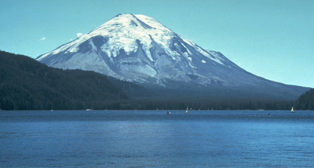
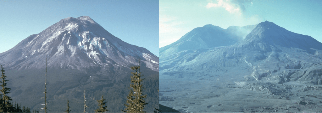
Explosive eruptions triggered by a sudden release in pressure can generate supersonic blast waves (directed blasts). These blasts can flatten trees, destroy property and kill (directly or via debris hurled by the wave). If the gases and ash released in the explosion are hot, they sear everything in their path. An example is the lateral blast wave produced by Mount St Helens at the start of the May 1980 eruption.
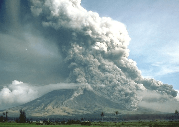
Eruption clouds:
These are the clouds of ash, gases and rocks propelled by the volcano into the atmosphere; the cloud rises through kinetic energy from the eruption and heat. Before the advent of aviation only the larger ash clouds posed a serious threat. Ash clouds may reach heights from hundreds of metres to tens of kilometres. If the ash cloud reaches the stratosphere it can have regional and global impacts on climate; ash filters out sunlight, cooling the air. Examples of climate impacting eruption clouds are Krakatau, 1883, and Tambora, 1815.
Ash, especially ash with a high silica content, is also bad for aircraft. Flying through an eruption cloud at speed is akin to flying through a large sand blaster. Ash abrades the outer surface of the aircraft, including the windshields and lacerates vulnerable parts. Engine heat also melts the ash, coating fuel nozzles and turbine blade with glass, which may stop the engines in seconds. An eruption as small as a VEI 3, is enough to put an aircraft at risk. Examples of aircraft in trouble are the VEI 4 eruption of Galungung, 1982 and VEI 3 of Redoubt, 1989. A BA flight encountered the eruption cloud from Galungung 150 km away from the volcano; all the engines cut out, were successfully restarted 2,000 m from the sea, after falling 9,000 m, only for the experience to be repeated when the plane flew back into the cloud (the plane later landed successfully in Java, despite having an abraded opaque windscreen); a Singapore Airlines flight was only able to recover two engines from the loss of all four after flying through the same cloud two weeks later. A KLM flight lost all four engines in the Redoubt ash cloud and got uncomfortably close to the Alaskan mountains before being able to recover.
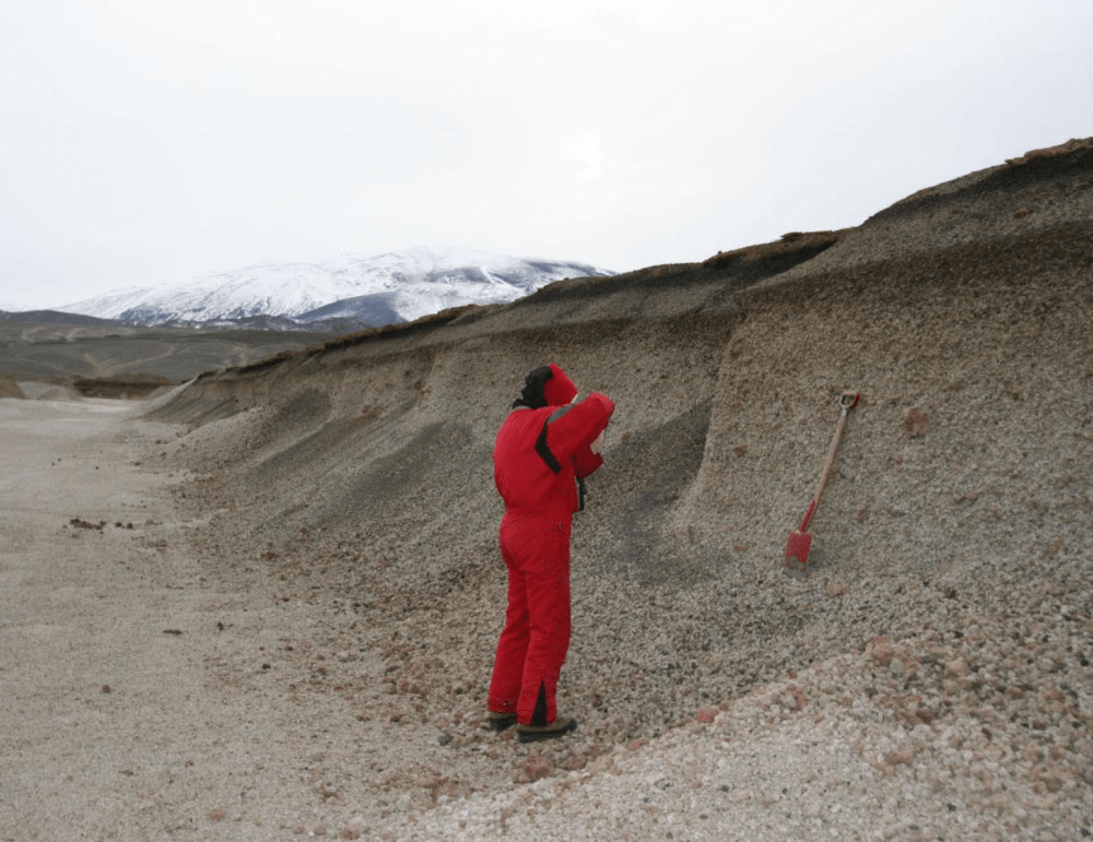
Tephra:
What goes up, must come down. Tephra is the ash and rock that falls out of the eruption cloud due to gravity. It is densest nearest to the volcanic vent; it can be dense enough to cut out all light by filtering out starlight, moonlight and sunlight; it may also cut the electricity supply, block roads and hamper rescue attempts.
The weight of accumulated tephra on buildings may cause them to collapse. If the tephra is combined with water, it may turn to concrete and be very difficult to remove.
Accumulation of tephra on the ground may cover vegetation, cutting off air and water to the plants: a layer as thin as 2.5 cm is enough to kill some plants, vegetation recovers within a year; a covering of 15 cm or more is enough to kill vegetation and sterilise the soil from which it takes decades to recover.
Tephra may also be rich in chemicals that are toxic to plants and the livestock that feed on them and contaminate the water supply. Fluorosis from ash is a common cause of death in livestock and people. Some minerals in tephra are also carcinogenic.
There is no shortage of examples of eruptions where tephra has caused loss of life; here are three: Pinatubo, 1991, Vesuvius, 79 AD, and Tambora, 1815.
Pyroclastic flows:
These are big killers. You cannot outrun a pyroclastic flow so unless you are right on the edge of a cold flow, or in an air-tight robust building, your chance of survival is zero. Pyroclastic flows are fast-moving surges of gases, ash and rocks propelled by gravity that flow down the sides of the volcano at speeds of up to 200 km per hour; heavy ash and rocks form a basal surge, whereas lighter ash may form phoenix clouds, propelled upwards by heat and turbulence. Small flows may travel up to 20 km and larger ones more than 100 km from the vent. Pyroclastic flows are generated by collapse of the eruption column or by lava domes (collapse of the dome or detonation by pressurised gas).
Pyroclastic flows deposit large volumes of ash and rocks; lumps of lava may be the size of a vehicle. If the flow is hot, the ash and rocks may be welded together as ignimbrite. Hot flows will ignite anything that is flammable. The area covered by the debris depends on the size of the eruption, a very large one may cover an area the size of Switzerland.
Again, there is no shortage of examples of pyroclastic flows, in addition to the three eruptions noted above, there is the VEI 4 1902 eruption of Mount Pelée, Martinique, in which two pyroclastic surges caused by dome collapse wiped out the capital St Pierre killing 30,000 and leaving 50,000 homeless; a third pyroclastic flow killed 2,000 in Morne Rouge.
Lava:
Lava flows are the lava which flows down a volcano or across open ground. Most lava is viscous and can be outrun; hazards tend to be damage to property, farm land, power supplies and communication lines. There are rare instances where lava flows have killed, such as Nyiragongo in 1977, when a fissure emptied the lava lake, producing basaltic lava flows with speeds of 30km per hour; where observers getting too close were casualties chunks of lava breaking off the flow or from the explosions where hot lava met water or ice; or where lava flows have cut off escape routes.
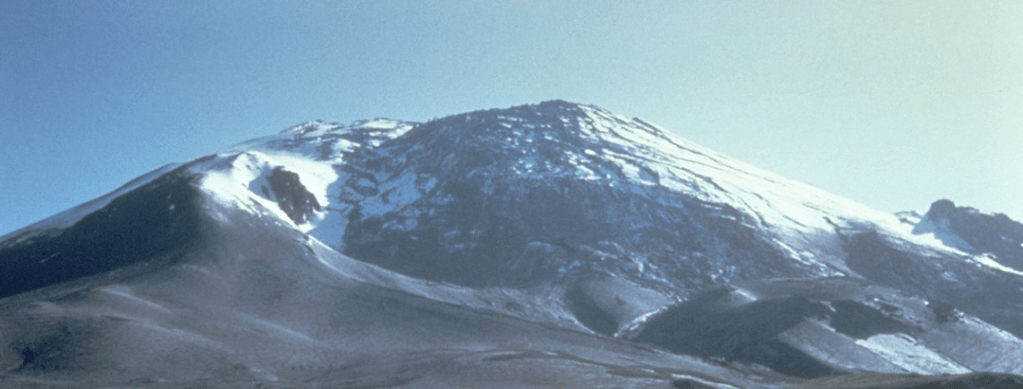
Lava domes are formed when more viscous magma builds up as a dome rather than flows. They tend to have a solid surface and may have spines of solid lava pushed up by magma from the centre of the dome. Lava domes may collapse under gravity causing block and ashflow eruptions or there may be a directed blast where a crack or collapse releases pressure. Examples where lava domes have claimed lives are Mount Pelée, 1902, Mount Unzen, 1991, Merapi, 1930, Mount St Helens, 1980 (cryptodome).
Debris Avalanche Flows & Lahars:
Volcanoes are made up of layers of loose ash and lava so are not very stable. They may suffer partial edifice collapse as a result of gravity, erosion or from the pressures generated during an eruption. The collapse causes debris avalanche flows – a fast moving, gravity driven currents of rocks, water and other materials.
Mount St Helens is an example of the debris avalanche flow triggered by magma: a dacite cryptodome destabilised the northern slope; a small earthquake caused the bulge to fail, its collapsing released superheated steam, resulting in the catastrophic eruption. Bandai volcano in Japan suffered failure of the northern flank set off by a small phreatic eruption in 1888; the avalanche had a volume of 1.5km3 and killed 461 people. Unzen in 1792 suffered sector collapse with no eruptive activity; the edifice failed under gravity alone.
A lahar is a water saturated debris avalanche flow (mudflow). Lahars may be triggered by heavy rainfall typical of the tropics or by the rain storms generated by an eruption. Rain washes loose ash and rocks into river valleys or gullies where they mix to torrential mud flows. Lahars can move at speeds of 90 km per hour. Mudflows, plus debris picked up, form torrents which destroy property and kill those caught in their path. A famous example of a catastrophic lahar is the destruction of the town of Armero in 1985 from a series of lahars resulting from pyroclastic flows 50 km away at the summit melting snow in a VEI 3 eruption of Nevado del Ruiz; most of the population of 28,700 were buried in several metres of mud.
Jökulhlaups:
These are glacial outburst floods caused by the melting of glacier ice by heat from magma near the surface or during an eruption. The water may accumulate under the ice in lakes, if its exit is blocked by ice, to be released as a flood when the ice dam breaks or floats. Jökulhlaups carry debris from ash, boulders and ice bergs from the glacier.
The term is Icelandic and here we can find many examples. One is the 1996 jökulhlaup from Grímsvötn with a volume of 3.5 km3, which reached a peak discharge of 45,000 cubic metres per second. Most of the damage was to roads, bridges and power supplies; not many people lived in the vicinity. Flood deposits covered 750 km2 and extended the coastline out by 800m.
Volcanic Gases:
Volcanoes emit gases (volatiles) both when erupting and not. The volatiles include sulphur dioxide, steam, carbon dioxide, hydrogen fluoride, hydrogen chloride, hydrogen sulphide and carbon monoxide; they may also include toxic compounds of arsenic, bismuth, cadmium, copper, lead, mercury, thallium and zinc. Volatiles can tell us much about the lavas: unevolved magmas (mid ocean ridge basalts) tend to contain less water than arc basalts and rhyolites. However, here we are concerned with the hazards posed by volcanic volatiles.
Volcanic emissions damage vegetation, mostly by the acidic effects on soil and foliage, reducing crop yields or stripping vegetation. Acidic gases may damage skin and irritate eyes and lungs. Hydrogen sulphide, like carbon dioxide, can accumulate in volcanic or geothermal areas, causing fatalities from neural, respiratory and cardiovascular damage or by asphyxiation. One such tragedy occurred at Lake Nyos on 21 August 1986 in Cameroon when a cloud of carbon dioxide released from the lake flowed down the volcano, asphyxiating the 1,700 people plus pets, livestock and wild animals in its path.
Earthquakes:
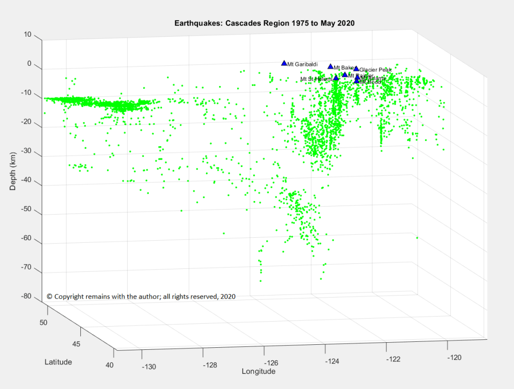
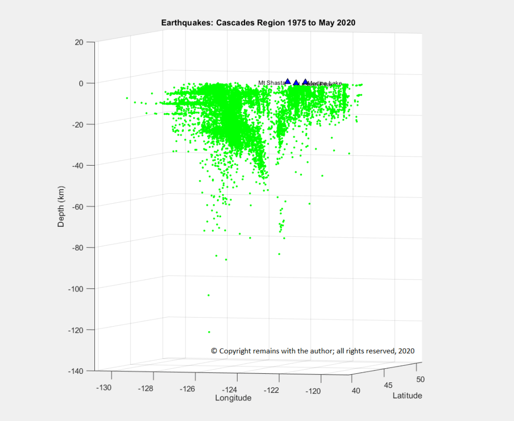
Volcanic activity rarely produces large earthquakes (over 6.0 M); the ground motion required to accommodate magma movement is relatively small. However, magma movement generates swarms of earthquakes which can run into the thousands. The accumulated shaking may damage property, weakening it to be more vulnerable to the effects of the eruption which may ensue.
Caldera formation:
I have not seen this mentioned as a specific hazard in its own right in my text books, probably because much of the hazard is covered by other factors, such as: the eruption cloud, tephra, lava flows, tsunamis and earthquakes, which may be considerable in a caldera-forming eruption.
A caldera is formed when the roof of the magma chamber sinks while its contents are being evacuated. In addition to the eruptive products, this may result in loss of land as we saw with Krakatau. The depression may fill rapidly with water (sea water or fresh water). Land loss is likely to be permanent resulting in loss of property, businesses, flora and fauna and anything else left on that land.
Tsunamis:
These are big killers. Volcanic tsunamis are generated when a large volume of sea water is displaced by ash deposited by a collapsing eruption columns, pyroclastic flows and edifice failure. Tsunamis may travel a long way, devastating shore-lines. Examples are Krakatau, 1883 and Tambora, 1815.
So why live near a volcano?
If volcanoes are such a threat, why do people live near them, or even on their slopes (assuming that they know that the beautiful wooded mountain is a volcano)? We’ll look at the reasons in more detail later, but in summary they are that large eruptions are not that frequent (the volcano may be in repose for decades / centuries); volcanic ash contains a lot of nutrients which lead to fertile soils, good for crops and livestock; the scenery is often unusual or attractive leading to tourism; and, if you were born or raised in the area, you may accept the risk.
We will look at volcanic risk mitigation over the coming weeks.
The Armchair Volcanologist
24 August 2020
© Copyright remains with the author; all rights reserved, 2020.
Sources and Further Research
“Volcanoes, Earthquakes and Tsunamis”, David Rothery, Teach Yourself, 2010
“Eruptions That Shook the World”, Clive Oppenheimer, Cambridge University Press, 2011
“Volcanoes”, Peter Francis, Clive Oppenheimer, Oxford University Press, Second Edition, 2004
