Good evening!
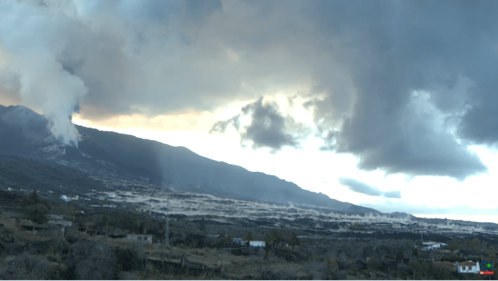
The eruption of Cumbre Vieja continues unabated with Strombolian activity, lava fountains from many vents, lava flows, and ash emissions. . As of 16 November 2021, Copernicus reported that 1,042.1 hectares of land have been covered by lava. Rainfall now adds to the hazards created by volcanic ash. The cone reached a height of 1,130m by 10 November 2021. Sadly, one fatality has occurred; one person who had gone to assist with ash clearance was found dead in his home.
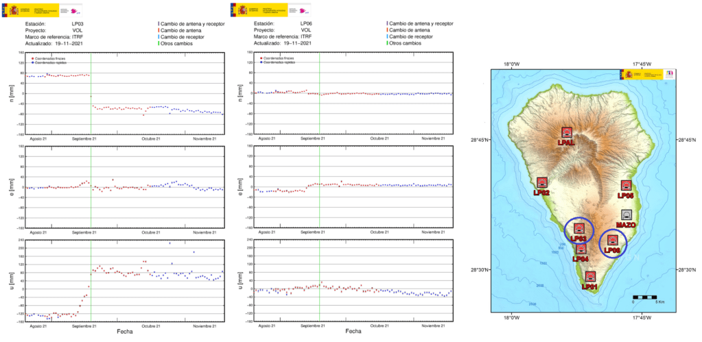
Seismicity picked up again in the last few days along with a ground uplift detected at GPS stations LP03 and LP06.
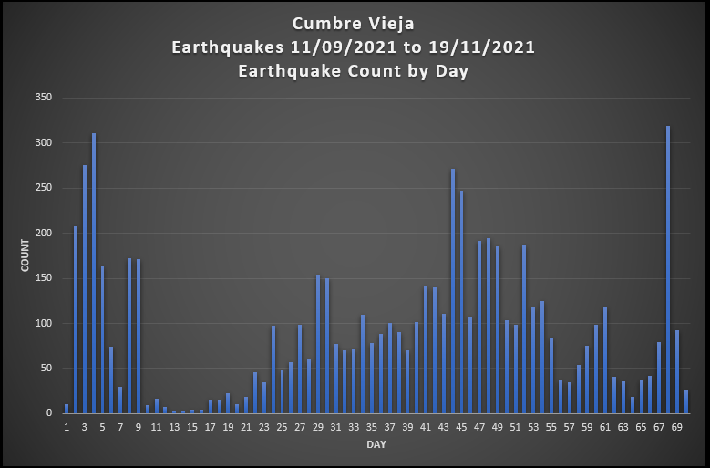
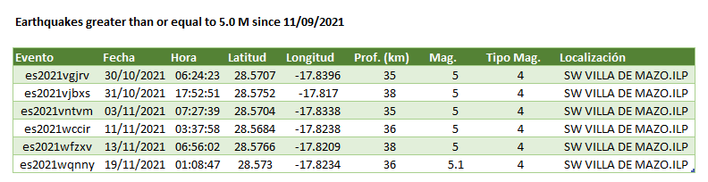
To date there have been 5 earthquakes of 5 Mag. or more.
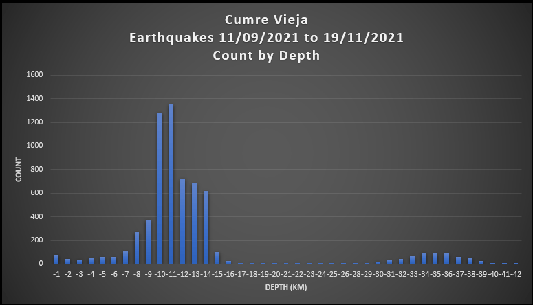
Here are updated earthquake plots. All of the action is centred around two depths: 7 -16 km and 30 -39 km, with a very few earthquakes in between; there are a few earthquakes with depths of more than 39 km.
For the updated video, we have provided the scatter plots for only earthquakes greater than or equal to 3.0 Mag. because the smaller earthquakes obscure the action; all earthquakes are included in the geoscatter plots.
Magma still appears to be stalling at the two depths: 7 -16 km and 30 -39 km prior to ascent (refer to La Palma: Earthquakes and Magma Plumbing for more information). How much of it reaches the surface remains to be seen.
Armchair Volcanologist
© Copyright remains with the author; all rights reserved, 2021.
Sources:
Raw earthquake data: Instituto Geográfico Nacional (IGN)
Other links are provided in the text.
